GrogNerd
mean old man
I was thinking "rocky gash"
but then I thought, "OUCH!"
but then I thought, "OUCH!"

Haha yeah that one was too easy. Minky, how'd you decide on Gunnison? And, yes Tele stands for telemark.
Here's my next one, should be fairly easy.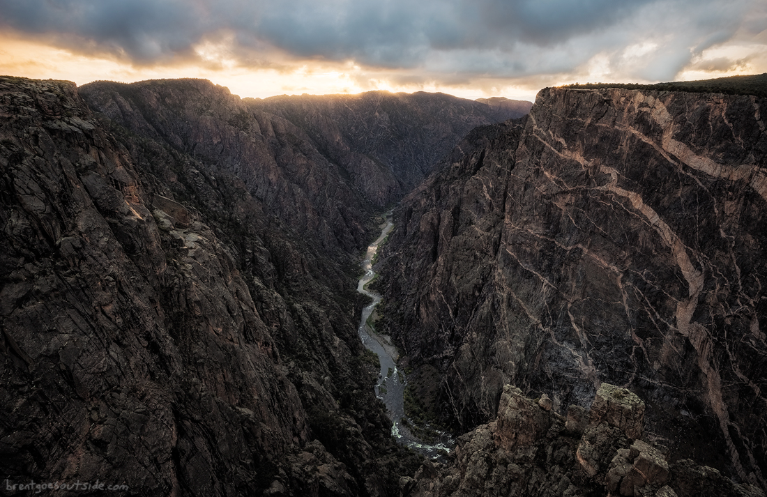


I had to show off a bit more of where I live!Not too far from home, huh tele?
I had to show off a bit more of where I live!
Alright, here goes View attachment 372142
Novate Mezzola, Italy?
Close, this town finds itself between Bergamo and a famous Italian source for mineral water.
Berbenno, Italy?
Close, this town finds itself between Bergamo and a famous Italian source for mineral water.
Sorisole. Cross is on Monte Canto Alto or something like that.
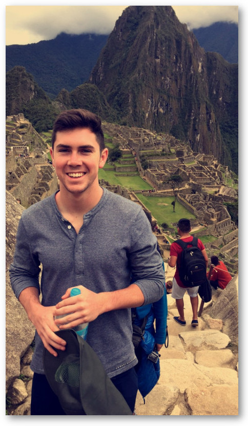
Machu Pichu in Peru
I've had a number of friends go there, and I see their pics on FB all the time so I recognized everything pretty quick.
With the exception of the guy in the pic. I'm not sure who that is, though I'd guess it is PassedPawn Jr. (for bonus points, of course).
I'll have a pic up shortly.


![Craft A Brew - Safale BE-256 Yeast - Fermentis - Belgian Ale Dry Yeast - For Belgian & Strong Ales - Ingredients for Home Brewing - Beer Making Supplies - [3 Pack]](https://m.media-amazon.com/images/I/51bcKEwQmWL._SL500_.jpg)